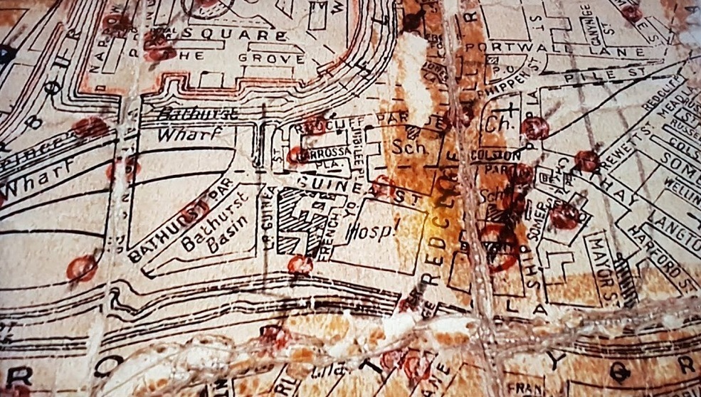
German military map
On 24th November 1940, German bombers targeted the Bathurst Basin area of Bristol. It was a Sunday when Bristol’s air-raid defences were at their least vigilant – the perfect time for the raid. The image shows the map used by the German military to identify Bathurst Basin as the target.

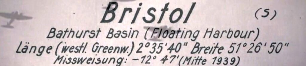
Bomb damage sites
This second image shows where bombs landed in this raid. The sites identified by the Civil Defence Committee and shown as red circles on the map, were opposite the Bathurst Hotel (Lousinana), Wapping Road, Bathurst Parade, Redcliff Parade, Barrossa Place, Commercial Road and Guinea Street, the last of which figured prominently in one of BBC 2’s series, ‘A House through Time’. Key structures of the Basin – like the two lock gates – were unaffected.