
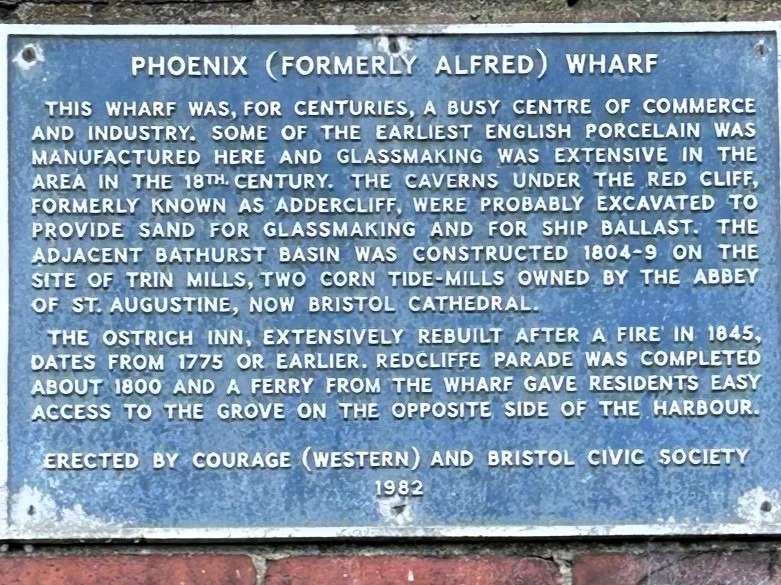
Bathurst Basin was built in 1809. Designed by William Jessop, it was intended as a feeder for the New Cut and as a secondary dock area to help relieve congestion in the main harbour. It was named after a Bristol MP and director of the Bristol Dock Company, Charles Bragg, who changed his name to Bathurst in 1804. It was built on an area of an old mill pond, the Treen (or Trin) Mill Pond. The pond was supplied by the River Malago, from Bedminster to the South. It lost its water supply as the New Cut was created in 1809, running to the south of the enlarged Floating Harbour and catching the flow of the Malago.
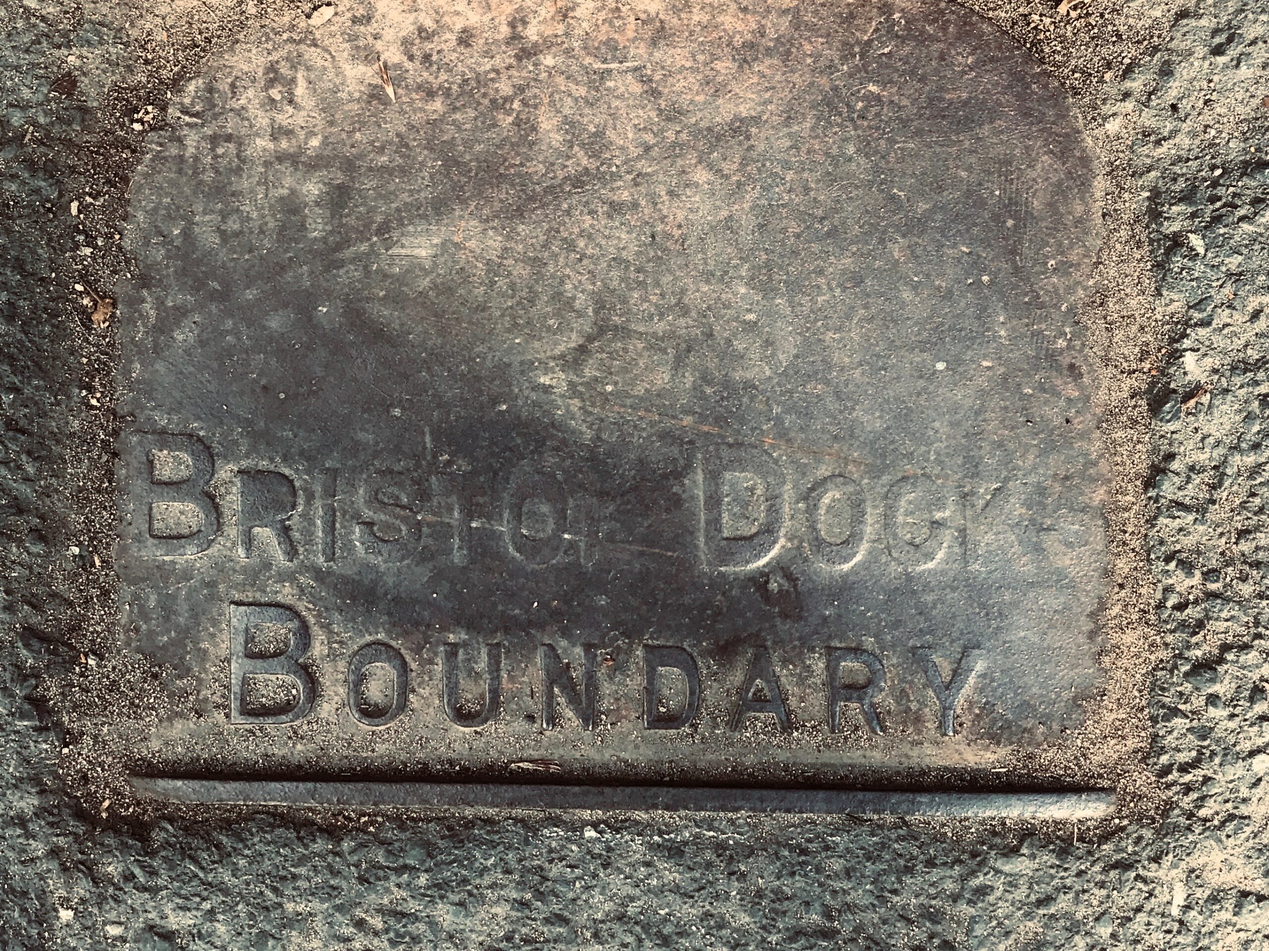
Access to the basin was through two sets of locks: one between the Floating Harbour and the second into the New Cut. The second connection enabled smaller vessels to bypass the main entrance locks in Cumberland Basin. From 1865 a deep water dock with a stone quay front was built. The basin used to be an industrial dock with warehouses and numerous shipyards at the adjoining Wapping Shipyard and Docks, including Hilhouse, William Scott & Sons and William Patterson. The 1934 aerial photograph of the Basin on the right is courtesy of Britain from Above.

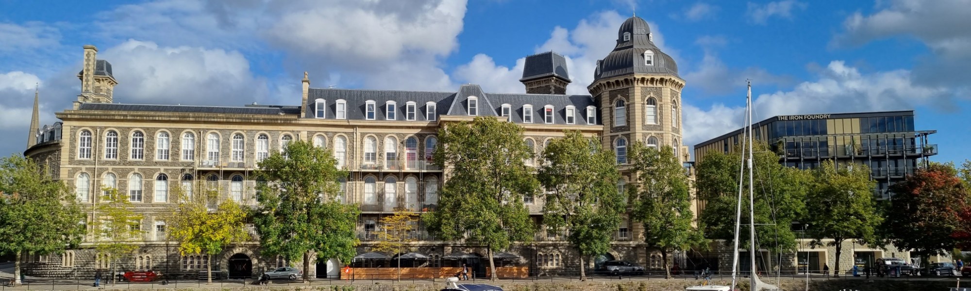
On its north-western quay, Bathurst Parade is part of the Merchants Landing estate, built in the early 1980s. Number 3 Bathurst Parade is named ‘Steam Packet House’, and it once was a Georges & Co pub called the Steam Packet Tavern. When the Bristol General Hospital (on the eastern side of the Basin) closed its doors in 2012, City and Country converted it into residences. The ground floor of the General now houses a Michelin-star tapas restaurant. In addition to the hospital renovation, City and Country built The Iron Works, named after the Acraman Iron Works that occupied this site in the 19th century. The ground floor of the Iron Works houses a dental practice and gym.
The night before the 1831 Queen Square riots, hundreds of sledge hammers were ‘borrowed’ from the Acraman’s Iron Foundry, situated on the eastern quay of the Basin. These hammers were used during the riots to break down the doors of the four prisons in Bristol. The day after the riots, all but two of these hammers were returned. This fact, at the time, was used as evidence of prior planning by the ‘mob’.
Historical sites and events around the Basin
-
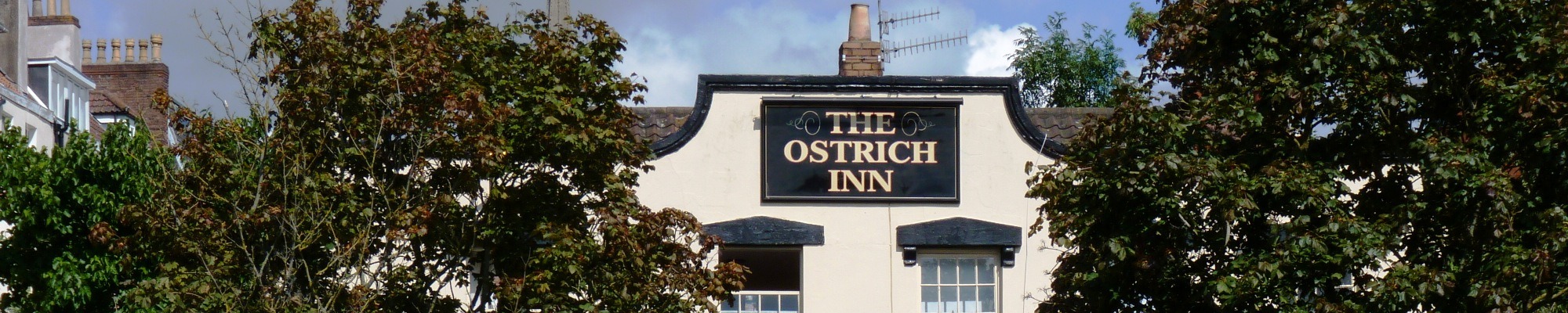
The Ostrich Inn
The Ostrich Inn was built around 1745 and the external appearance of the Ostrich has changed little over time.
-

World War 2 bombing
On Sunday, 24 November 1940, German bombers targeted Bathurst Basin, the raid killing 171 individuals and a further 174 were injured.
-
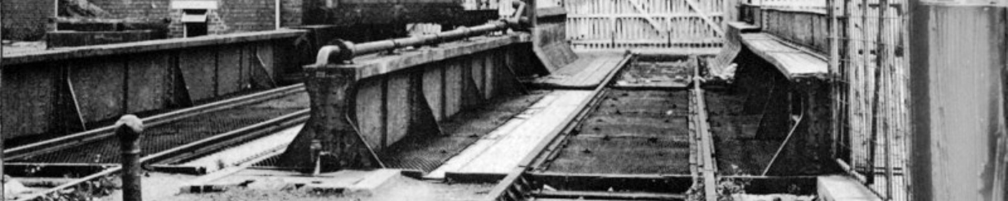
Bascule bridge and Redcliffe Tunnel
A rail link from the harbour to Temple Meads passed over a bascule bridge close to the Ostrich and through the Redcliffe tunnel.
-
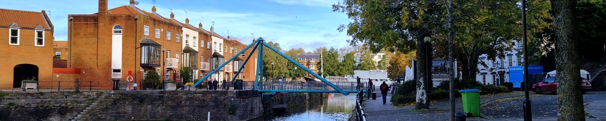
Lower Guinea Street Bridge
In the early 1980s the old bascule bridge in front of the Ostrich was replaced by a pedestrian swing bridge.
-

The John Sebastian Lightship
Built in 1885 in the same dock as the SS Great Britain, the lightship was responsible for saving hundreds of seamen in her hard-working life.
-
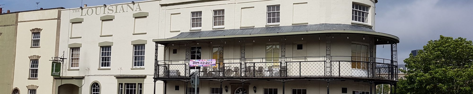
The Louisiana
The Louisiana Pub was built in 1809, then called the Bathurst Hotel and subsequently renamed the Garricks in 1978 and the Smugglers in 1982.
-
The General
The General Hospital was established in 1832 with 20 beds and in 1858 work began on the buildings you see now.
-
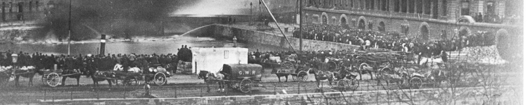
Explosion at Bathurst Basin
In Bathurst Basin on the morning of 21st November 1888 300 barrels of naphtha on ‘United’, a Jersey schooner, ignited.
-

Harry Brown in the Basin
The sand dredger Harry Brown discharged in Bathurst Basin in the 1960s and 1970s.
Four local plaques: click to view


The Braikenridge Collection
George Weare Braikenridge FSA (1775–1856) was born in the Colony of Virginia, but lived most of his life in Bristol, where he created a large collection of Bristolian historical and topographical material known as the Braikenridge Collection. The full collection of over 1400 pictures is held at Bristol City Museum and Art Gallery who have granted permission for 600 images to be published on Know Your Place. The images and text below are taken from this site.


